top of page
183172226_487760752642532_7221842979784382465_n.jpg

aspiring geoparks

jocelyneaudard4.jpeg

CHARLEVOIX ASPIRING GEOPARK

Charlevoix is a region of Quebec, located on the north shore of the St-Laurent, about 1:30 northeast of Quebec City. One of the peculiarities of the territory, at the geological level, is that it contains parts of the three major geological provinces of Quebec. First, the majority of the territory is made up of the Canadian Shield; old igneous and metamorphic rocks whose ages approach a billion years, and which once formed the roots of an immense mountain range: the Laurentians. Over the Canadian shield, in some places, we find ancient marine deposits about 450 million years old: the sedimentary rocks of the St. Lawrence Lowlands. The last geological province is represented by Isle-aux-Coudres, which belongs to the Appalachians. It too is made up of ancient sea beds. However, these formed thousands of kilometres away about 500 million years ago. Tectonic movements of the Earth's crust along the Logan Fault have pushed these rocks towards the Canadian Shield for hundreds of millions of years.


To add to the complexity of the territory, Charlevoix was then struck by a huge meteorite, about 400 million years ago. The characteristic relief of the central part of the region is therefore that of an ancient meteorite impact crater about 54 kilometres in diameter! We can still see, even today, traces of the transformations that this event brought to the local geology.

  • Untitled design-25
  • Untitled design-24
CHARLEVOIX
62092_dbc_1200_px.jpeg

FIRE & ICE ASPIRING GEOPARK

Islands colliding with continents. Land rising up and mountains falling down. Grinding glaciers and volcanoes erupting through them. Over the past 200 million years, these processes created the globally unique landscape of British Columbia’s Fire & Ice Aspiring Geopark. But it’s far from over: the area remains the most geologically active in all of Canada.


From coastal rainforest to dizzying peaks, lava flows to thundering waterfalls, and underwater moraines to the steaming vents of a dormant volcano, some 70 geosites tell an end-to-end story of ongoing mountain building, glaciation, volcanism and collapse—landforms that spawned their own stories for the Squamish and the Lil’Wat First Nations who have shared this territory since time immemorial.


The Fire & Ice Geopark is a passport to a fascinating past—and an ever-evolving present.

  • Untitled design-25
  • Untitled design-24
  • Instagram
SEATOSKY
NIAGARA
brock-monument-niagaralandbetweenwaters-markzelinski.jpeg

NIAGARA ASPIRING GEOPARK

Building on a fascinating geologic foundation over 500 million years old, with world-renowned Niagara Falls as its beacon, the Niagara Peninsula Aspiring Geopark takes its cues from what Indigenous peoples have been doing here for thousands of years; meeting, trading, sharing stories, harvesting food and establishing a strong family and cultural ties.

​

The Geopark is a non-regulatory, non-profit entity that benefits all Niagara residents, educational institutions and business operators by fostering regional, provincial, national and international tourism, developed in such a manner and at such a scale, that it remains viable indefinitely while safeguarding the Earth's life support systems on which the welfare of current and future generations depend

  • Untitled design-25
  • Untitled design-24
  • Instagram
  • Facebook
  • Twitter
  • LinkedIn
  • Youtube
CABOX
blow-me-down-mountains.jpeg

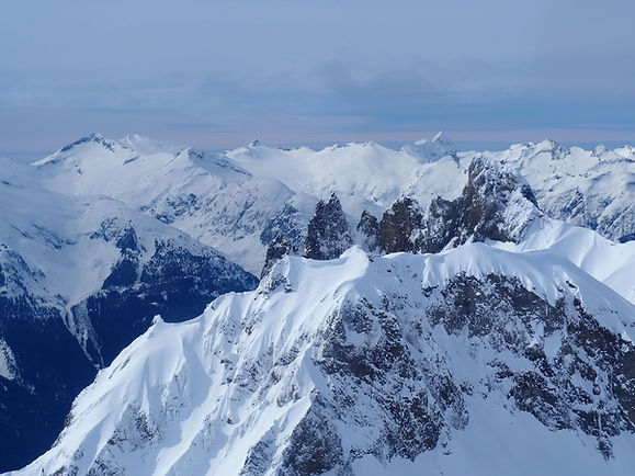
CABOX ASPIRING GEOPARK

Cabox Aspiring Geopark is currently located in Western Newfoundland; however its origins can be traced back to the Tropics, where 500 million years ago it lay at the eastern edge of the landmass that would become North America. Its unique geological record spans the closing of the proto-Atlantic Iapetus Ocean and formation of the Appalachian Caledonian Mountains.


From the Little Port Island Arc and Bay of Islands Ophiolite Complex to the Transported Continental Margin and Ancient Continental Slope of Laurentia, the region at the core of the Humber Arm Allochthon exhibits both the geologic and academic story of plate tectonics and associated mountain building processes. Significant geological features include ophiolite massifs composed primarily of ultramafic peridotite from the earth’s mantle and mafic gabbro from the ocean floor, as well as sedimentary folds, faults, thrusts and synclines composed of bedded limestone, sandstone and breccia from the continental slope and shelf. 

​

Fast-forward to the mid-18th century when renowned surveyor, cartographer and explorer James Cook drew an outline of the region, which prominent geologists, including Alexander Murray, James Howley and Harold Williams proceeded to "color” in. In 1978, Williams published his Tectonic Lithofacies Map of the Appalachian Orogen, which described and delineated the Appalachian Mountains, from Georgia to Newfoundland.

  • Untitled design-25
  • Untitled design-24
  • Instagram
  • Facebook
GEORGIAN BAY
295384277_463688461836793_5577827873282927211_n.jpg

GEORGIAN BAY ASPIRING GEOPARK

Georgian Bay is the fifth and smallest (15,000 km2) Great Lake but its shoreline exposes the most diverse geology found anywhere in North America, recording in total more than 2 billion years of Earth history.


This diversity reflects its location astride the southern boundary of the Canadian Shield where rocks are as old as 2.4 billion years, and much younger Paleozoic fossiliferous sedimentary rocks to the south that are some 400 million years in age. Its opposing shores afford great contrasts in landscape from the Thirty Thousand Island area in the east where white pines grow out of the ancient Precambrian rocks so beloved of the Group of Seven, to the bold promontory and limestone plains of the Bruce Peninsula to the west where the Niagara Escarpment falls dramatically into deep water.

​

The region’s Geology has shaped a significant and representative human story. There is a rich legacy of indigenous culture who recognized the spiritual importance of its varied landscapes and the many moods of the Bay. The first inhabitants were hardy Paleo Indians who camped some 11,000 years ago along the shoreline of Glacial Lake Algonquin while tracking caribou herds roaming along the edge of the last ice sheet. 


Georgian Bay's geological history is in the billions of years and is a unique window to the deep processes that formed and continue to impact the evolution of planet earth. The incomparable beauty and natural wealth of Georgian Bay attract people from around the world to explore its 30,000 island archipelago and experience the purity of its waters.

  • Untitled design-24
  • Untitled design-25
  • Instagram
Devils_Rock_crop.jpeg

TEMISKAMING RIFT VALLEY ASPIRING GEOPARK

The formation of the Temiskaming Rift Valley 450 million years ago is responsible for much of that which distinguishes Temiskaming District from the rest of northern Ontario today. From the agricultural plains of the Little Clay Belt to the mineral deposits that have given us such a rich mining history, this system of faults and rifts has provided an enduring and unique legacy.  There are "kimberlite pipes" within the rift valley that are considered to be diamond bearing.

​

Temiskaming is built on the same Archean basement rock that underlies almost all of Canada, the Precambrian or Canadian Shield.  It also lies within an ecoregion known as the Boreal Forest, which covers almost 60% of Canada’s land area, forming a continuous belt from the east coast to the Rockies. Scientists call the area where the Canadian Shield and the Boreal Forest overlap the Boreal Shield, the largest of Canada's 15 terrestrial ecozones.

  • Untitled design-24
  • Untitled design-25
TEMISKAMING
bottom of page